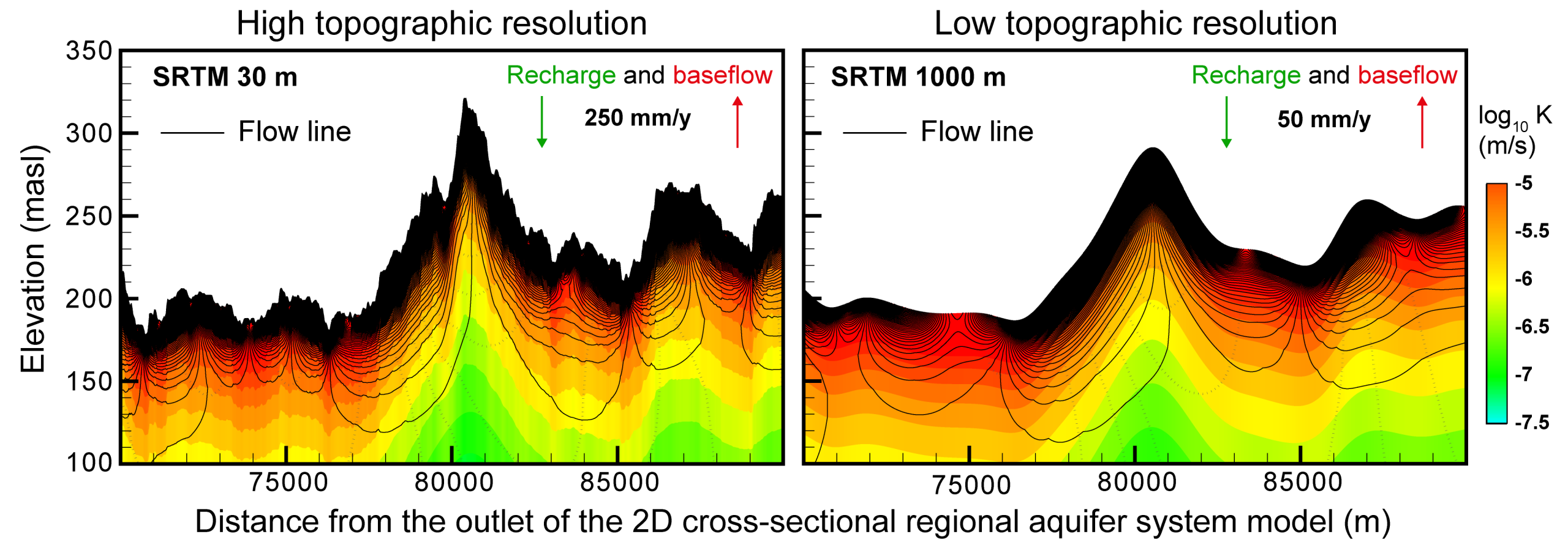
Regional groundwater models often use smoothed topography to reduce computational burden—but what does this shortcut actually cost? Here, the team examines how “water table smoothing” propagates into simulated flow patterns and groundwater–river exchanges. Using a 95-km 2D cross-section based on the hydrogeology of Québec’s St. Lawrence south shore (Canada), they imposed a water table that mirrors topography and progressively coarsened DEM resolution from 30 to 10,000 m, while maintaining the same high-resolution model mesh. The results are striking: As resolution decreases, hydraulic gradients weaken and key fluxes drop sharply. Simulated baseflow to the Yamaska River falls from 532 to 109 m³/yr/m (resolution 30 m vs 1000 m), and shallow groundwater becomes significantly older, while deeper regional flow paths remain broadly stable. The study shows why coarse models may appear to require higher hydraulic conductivity during calibration—potentially masking a structural bias. These findings are important for regional water budgets and scenario testing. Published in Hydrogeology Journal: https://doi.org/10.1007/s10040-025-03003-0.